 STORY BY KYLE ELLISON | PHOTOGRAPHS BY HEATHER ELLISON
For the first time visitor, Keone‘ō‘io, on Maui’s southern coast, might look completely empty. With the sole exception of a faded green port-a-potty and a nearby, gated luxury home, there doesn’t seem to be very much here: no buildings, no stores – no pavement. But spend a day on this rugged shore, where South Maui runs out of road, and you’ll find this outpost isn’t empty – but full – of adventure, history and color.
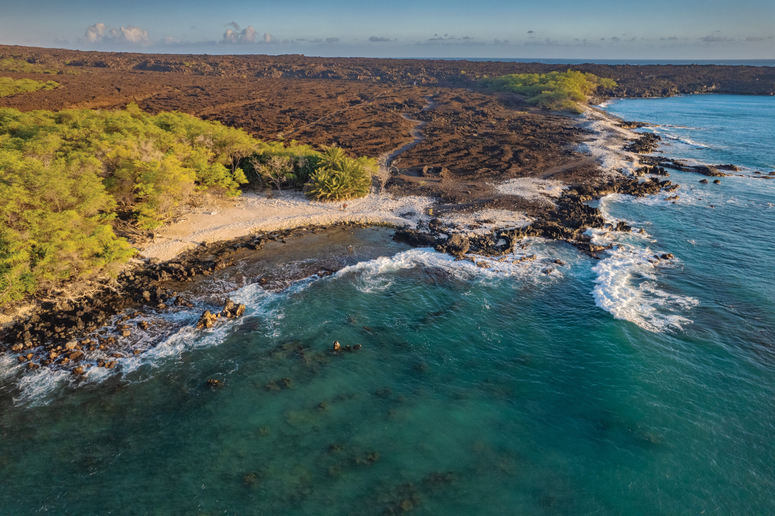
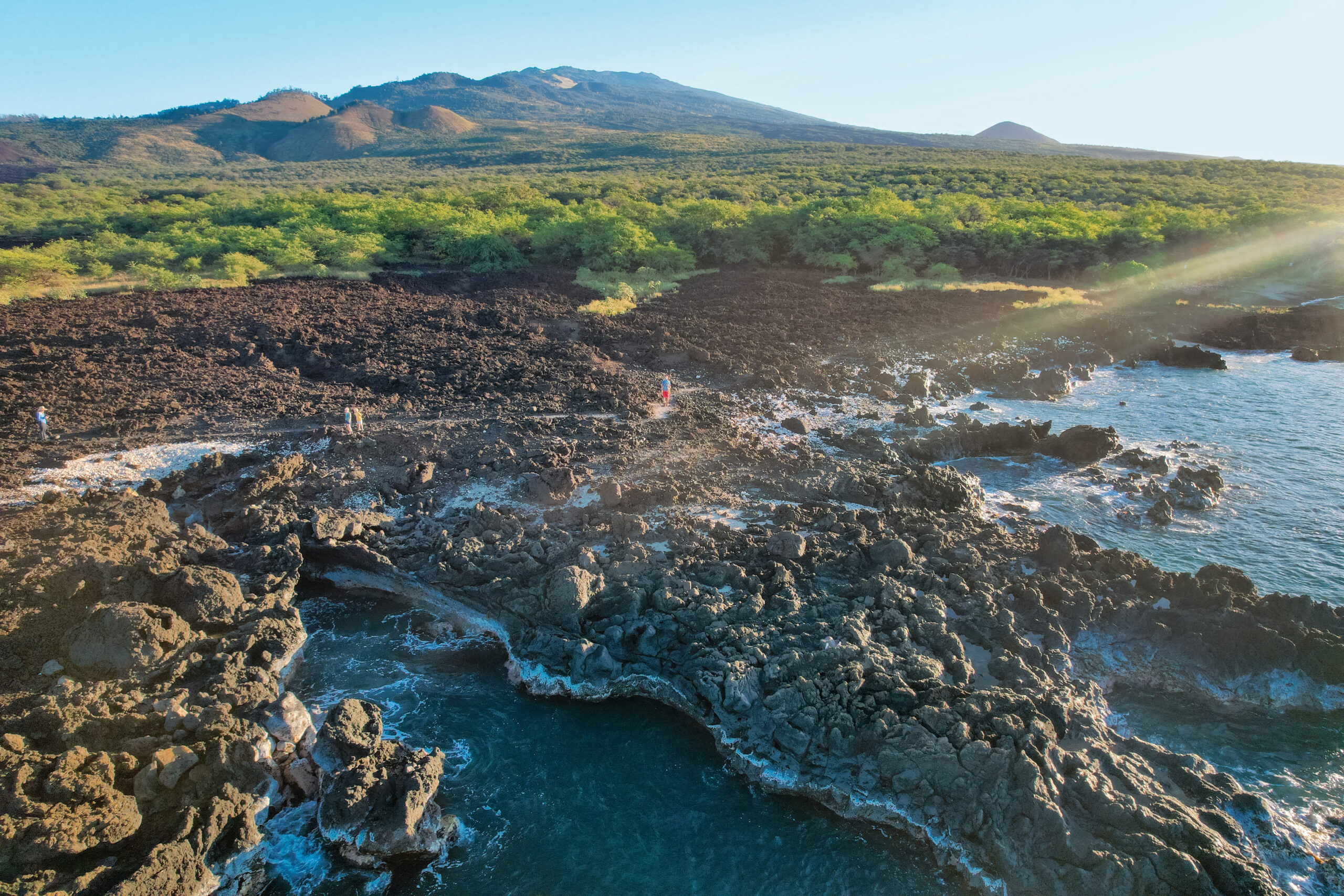
Just seven miles south of manicured Wailea, Keone‘ō‘io is anything but. Here lies a windswept, rocky hinterland that crosses a swath of jagged black lava that was born from Maui’s last eruption. Oral accounts and explorers’ logs suggest that took place in 1790, but radiocarbon dating of the rocks puts it closer to 1600. Regardless, when driving the narrow entrance road across the craggy field, you can clearly make out where lava emerged from the splatter cone, Kalua o Lapa, and left its mark on the coastal landscape, like a spilled can of black paint.
Also known as “La Perouse Bay,” this sheltered cove at the end of the road is where the French explorer, Jean-François de Galáup, comte de La Pérouse, became the first Westerner to leave footprints on Maui when he toured this coastline in 1786. During that visit he noted four or five villages, each with 10 to 12 thatched roof houses, built out of lava rock walls.
Fast-forward a couple of centuries, and those rock walls are still here today. They’re part of a vast archaeological site that’s seemingly frozen in time, and where visitors are asked to tread carefully, and with respect, so as not to disturb any stones.
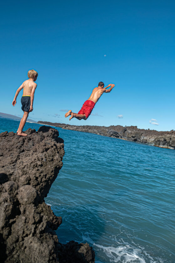
While the parking lot at Keone‘ō‘io may be the end of the road, it’s the gateway to one of Maui’s most scenic and fascinating adventures on foot. There are also times, during periods of light winds, and when seas are glassy and calm, where the bay is a popular spot to go snorkel, and pods of nai‘a, or Hawaiian Spinner dolphins, occasionally venture near shore.
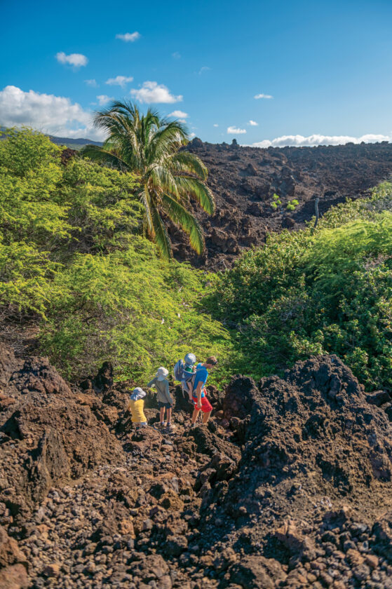
Be warned, however, for all its beauty, this hiking journey is only for those who come extremely prepared. Jagged shards of a‘a lava will rip rubber slippers to shreds, and there’s no cell service, water, food, facilities, rangers – or shade. The sun can be searing by 8 am, and to ensure you have enough water for the journey, pack double the amount you’d normally bring, and leave an extra bottle in the car, so it’s waiting there when you’re done. Or, to escape the brutal heat, hike at dawn and dusk – though be sure to also pack a headlamp if you’re planning to watch sunset from the trail.
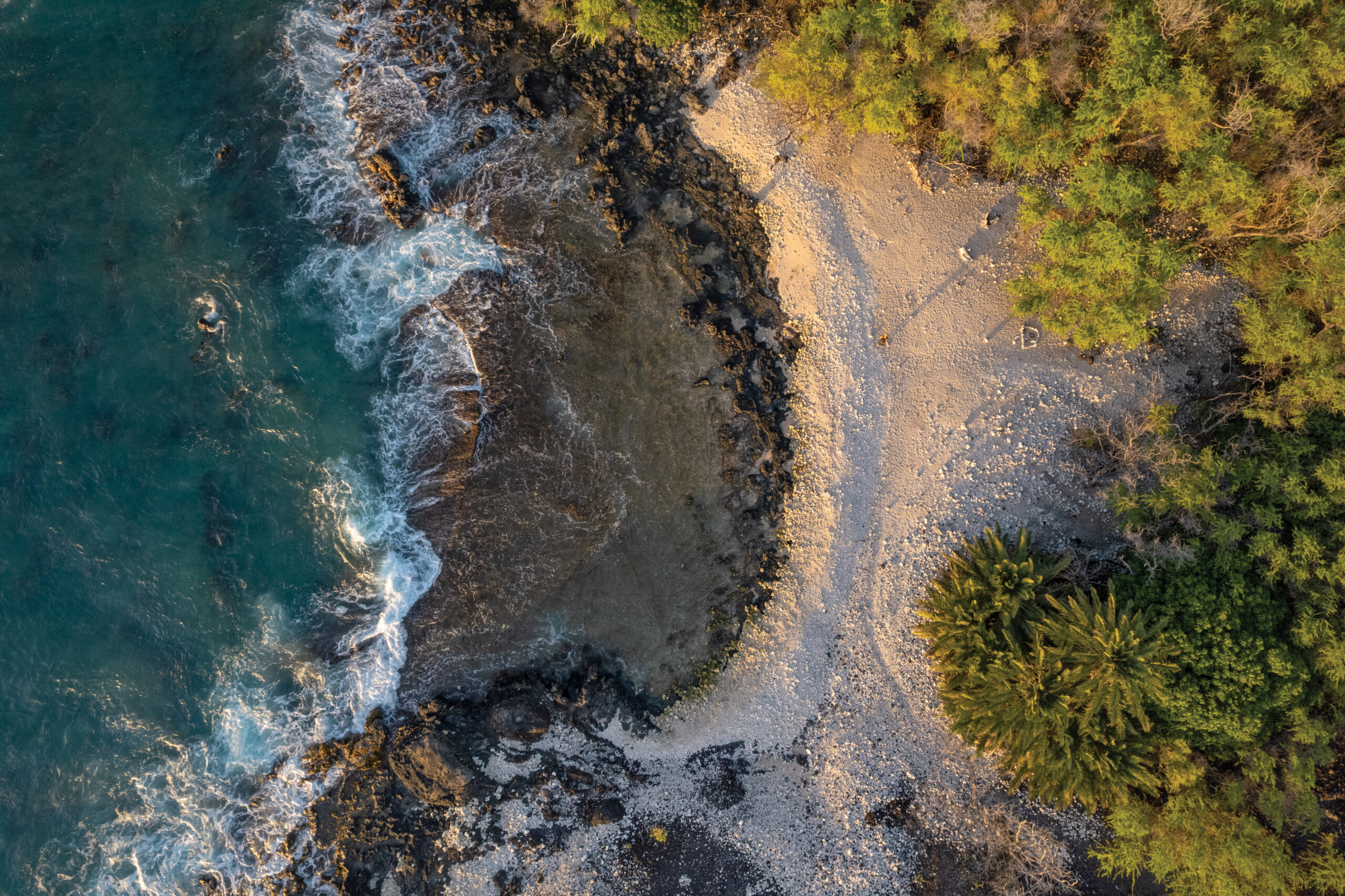
That said, you don’t have to walk the entire six miles to experience this coastline’s magic. The first half-mile features thundering blowholes, which, during days with large surf and high tides, send sea spray in to the sky. Small pockets of soft white sand – just large enough for a single beach chair – sit tucked between fingers of jet-black lava, gazing out toward turquoise coves. Yellow beans from kiawe trees line a sandy footpath that leads to beaches completely covered with white coral, and if you look closely, you might encounter a herd of wild goats.
After the first mile – which is the easiest and most accessible – the trail reaches an unmarked junction and splits into two separate adventures. One leads to the light tower at Cape Hanamanioa, and the other crosses a two-mile void along the Hoapili Trail.
Bear left, along Hoapili Trail, and soon you’ll be following the rocky footsteps of ancient Hawaiian royalty. This path was part of the “King’s Highway,” which once encircled the island, and this particularly impressive – and modern – stretch was commissioned in 1830 by Governor Hoapili. Constructed by laborers as a form of punishment for sins, including adultery, the improvements to a narrow, pre-existing path, were lauded by early visitors and historians as a feat of early engineering.
The original route was widened from a footpath to one which could accommodate horses, and the lava rock curbs that line each side led the Rev. Harry T. Cheever, in his 1851 book, Life in the Sandwich Islands, to label the trail “the noblest and best Hawaiian work of internal improvement I have anywhere seen.”
More than just a walk back in time, however, the Hoapili Trail allows modern explorers to access hidden, tucked away beaches that only the hardiest fishermen and hikers will ever have the chance to see.
One, Keawanaku, is set at the base of a coconut grove that springs from the chaos of black lava. It’s set down a spur trail, and out of view, of the main, much wider path, but follow a trail that leads toward the palm trees, and you’ll soon reach an enclave of rocky gray sand, which on calm days, beckons a swim. Currents and waves can be strong here, however, so do so at your own risk.
Even if you don’t choose to splash in the surf, you can still make out some ancient home sites that sit by the base of the palms. Abandoned around 150 years ago, the simple sites, with four rock walls, hearken an amazing, almost incomprehensible time, when Native Hawaiians didn’t just survive on this coast, but also managed to thrive.
Continue on, to Kanaio Beach – which is the furthest section of Hoapili Trail that’s open to public hikers – a large shoreline of bleached white coral abuts a tumultuous sea. While the beach doesn’t offer much in the way of swimming, it’s the sheer isolation and sense of accomplishment that offer the greatest reward. Here is a spot where the only sounds are of crashing waves, the whistle of wind, and your own feet striking the shore. There’s a raw and powerful energy to being in rarely visited spots, as nature has a way of hitting our “reset,” and reminding us that, in the larger scope of time, how small we really are.
You can find this same scenic, silent escape on the Cape Hanamanioa cliffs – a route that is much more accessible, and shorter, than the trek to Kanaio Beach. Granted, you don’t get the chance to hike the historic Hoapili Trail, but it’s a trade-off for sweeping ocean views that include the backside of Molokini Crater, and the island of Kaho‘olawe, in the distance.
After half a mile of crunching across lava rocks from the junction with Hoapili Trail, the humble light tower at Cape Hanamanioa suddenly flashes into view. From this elevated perch, about thirty feet above the cobalt sea, hikers are rewarded with unobstructed views that stretch from Haleakalā’s 10,000-foot summit, to a distant horizon where the closest landmass is 1,300 miles away.
Standing atop these wind-battered rocks, there’s a grandiose sense of serenity, and seclusion, that almost acts as an untethering, of sorts, from our hyper-connected world. Here it’s possible to sit and be present, to bask in the fullness of emptiness, and enjoy this nexus of land and sea, on a coast that time has forgotten.![]()